d@nyal
Member
سلام . من همچین گشتی توی این نرم افزار زدم گفتم گزارشش رو هم برای شما بدم ببینین چه خبره ؟!!
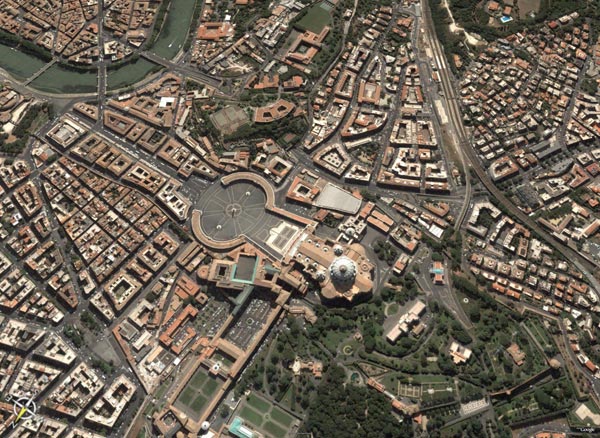
خدمات کسایی که تابحال کار نکردن عرض کنم که این نرم افزار یک نرم خدمت از گوگل هستش که بوسیله اون میتونید از هرجای دنیا مثلا شهرتون با تصاویر ماهواره ای دیدن بکنبن .
بعد اینکه وارد نرم افزرا شدید ( و کانکت شدید ! ) توی شمال غربی مانیتوی یه جا هست که میتونین بزنین iran و جستجو کنین . بعدش یه عکی تیره و تاز ایران میاره که به تدریج درست میشه . بعد هی زوم می کنید و اون هم به تریج درست تر میشه ! به همین سادگی .
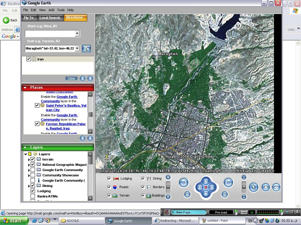
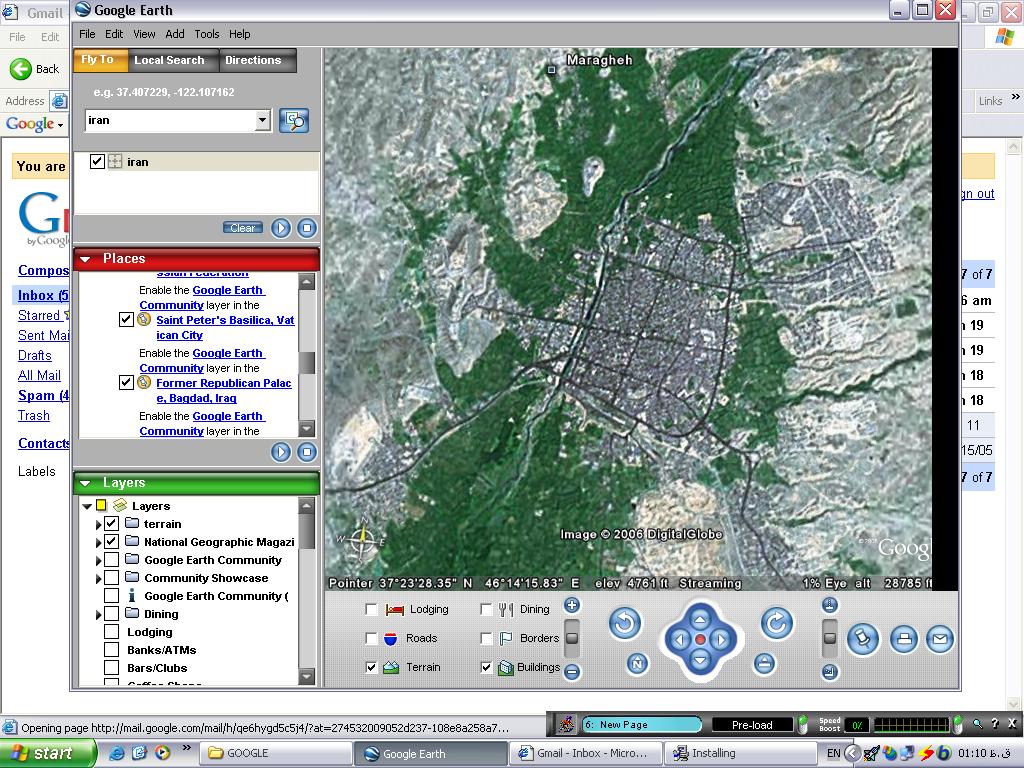
این عکس ها هم از بالای شهر ( شهرستان - شهر - بخش - روستا - ده و .... - هر چی میتونین بگین ! )ما هستن که من بیشتر از این نتونستم روش زوم کنم . فکر کنم بیشتر از این پولی باشه .
این آبی هم که بالا می بینین سد بالای شهر ماست که منتظره که بشکنه تا ما رو با خودش ببره !
همین !
از سایت گوگل هم می تونید اینو دانلود کنین .
مرسی دانیال
خدمات کسایی که تابحال کار نکردن عرض کنم که این نرم افزار یک نرم خدمت از گوگل هستش که بوسیله اون میتونید از هرجای دنیا مثلا شهرتون با تصاویر ماهواره ای دیدن بکنبن .
بعد اینکه وارد نرم افزرا شدید ( و کانکت شدید ! ) توی شمال غربی مانیتوی یه جا هست که میتونین بزنین iran و جستجو کنین . بعدش یه عکی تیره و تاز ایران میاره که به تدریج درست میشه . بعد هی زوم می کنید و اون هم به تریج درست تر میشه ! به همین سادگی .
این عکس ها هم از بالای شهر ( شهرستان - شهر - بخش - روستا - ده و .... - هر چی میتونین بگین ! )ما هستن که من بیشتر از این نتونستم روش زوم کنم . فکر کنم بیشتر از این پولی باشه .
این آبی هم که بالا می بینین سد بالای شهر ماست که منتظره که بشکنه تا ما رو با خودش ببره !
همین !
از سایت گوگل هم می تونید اینو دانلود کنین .
مرسی دانیال
آخرین ویرایش: